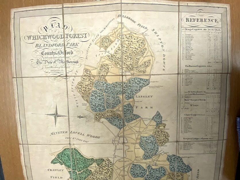
Enclosure maps were maps that showed the approved re-allotment of open and common fields, and were drawn up by surveyors appointed by enclosure commissioners. The maps typically depict, in some detail, a post-enclosure plan of the parish with the lines of the new boundary hedges or fences, drains, and roads marked. Some examples of enclosure maps will also show the boundaries of the former open fields and commons drawn on the plans.
Before the 19th century, enclosure awards were less likely to have an accompanying map; instead the award would describe the location of the enclosed areas in great detail using words. By the end of the 18th century, however, it had become the usual practice for every enclosure award to include a map as well.
There was no standard format for what an enclosure map would look like. Local practices would influence how they would appear and as enclosure maps had been drawn up over a long period of time the conventions that had been used in the area will have influenced how they looked in that particular place. Cartographers could choose, for instance, the scale used for the map and even down to how the map related to the points of the compass – north is not always at the top of the map and may be not where a modern map user may expect.
Enclosure maps can be found in various shapes and sizes: some will be rolled, others may be folded, and some are flat sheets. It is also possible to find them in a variety of sizes ranging from very large and cumbersome to quite neat and small. What material is used is another source for differences; some may have been drawn on parchment while others are on paper backed with linen. Usually, however, an enclosure map will be hand-drawn and coloured.
Do all enclosures have a map?
Not all enclosures will have ever had a map, even in the case of parliamentary enclosures, as some awards were prepared without an accompanying map. In the case of parishes that were enclosed by private agreement, rather than by Parliamentary Act, such agreements rarely had a map drawn up at all.
Will my building be marked on the enclosure map?
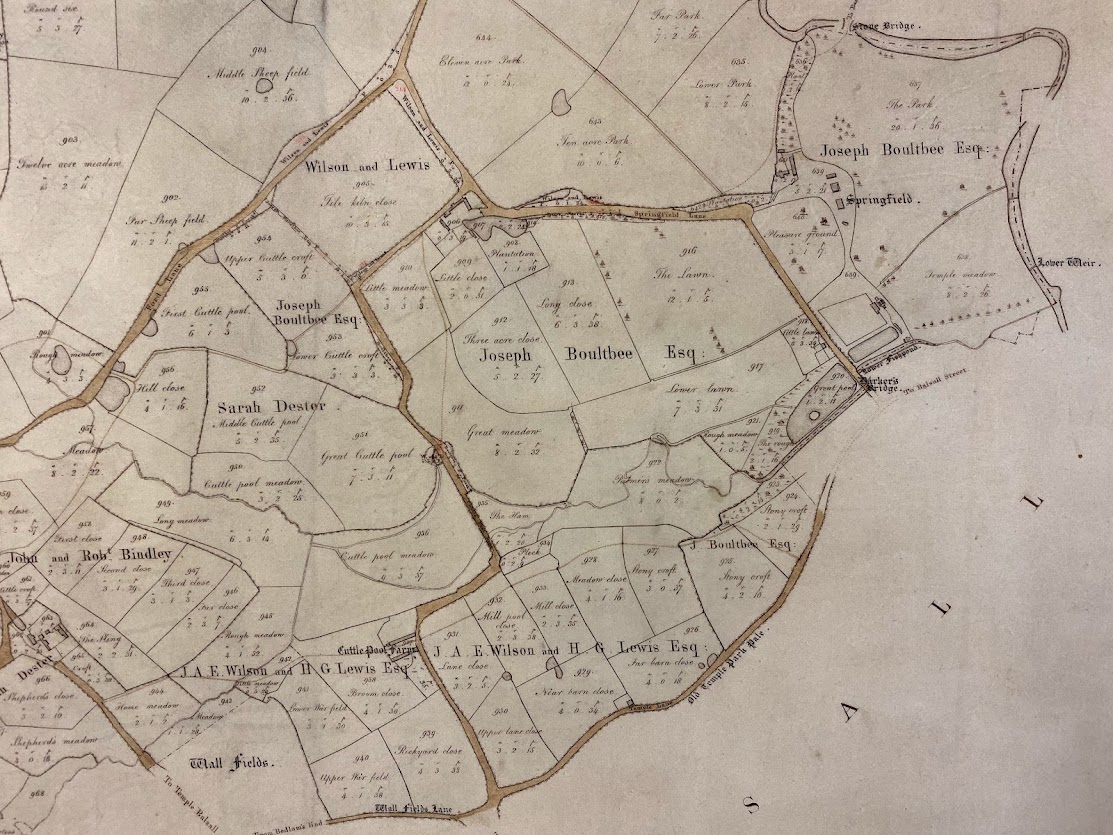
The inclusion of buildings on enclosure maps was usually less important to the person drawing up the map. The map’s purpose was to show the enclosure of the open and common fields and not the location of buildings in the landscape. When buildings are shown on these maps they often feature only in block plan. If you are looking at an enclosure map in order to see if your ancestor’s house existed in the time period when it was drawn then some care is needed. Just because the building is not depicted on the enclosure map does not necessarily mean that it didn’t exist on the site, just that it wasn’t drawn. Also, the depiction of a building on these maps only proves that there was some sort of a building on the plot and it certainly can’t be assumed that it was the building you are researching as this may be a later construction on the same site.
What are the numbers on the enclosure map?
An enclosure map will usually display a number for each plot that was to be enclosed. This plot number will then correspond to the description in the award where various details are recorded, including the person to whom it is allotted, the acreage and location of each plot. The map can be annotated to detail the extent of the plot, in acres (a.), rods (r.) and perches (p.).
Enclosure maps are important as they often provide the first accurate mapping of an area and sometimes may even be the first map that has actually been drawn up at all for that particular area. Their purpose, however, was to show the approved re-allotment of the open and common fields, and waste land, and not to map where all the buildings or features were, so should be used with that in mind.
Enclosure maps are typically found in county record offices. There is an online project cataloguing enclosure maps. See also our list of major map collections.