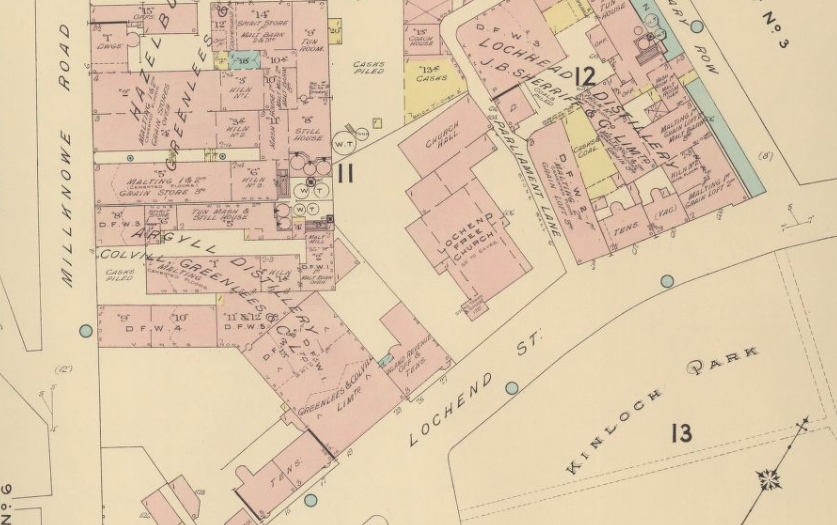
Insurance maps were introduced into Britain by Charles Goad (1848–1910). Though he was an Englishman, having been born in Surrey, he moved to Canada in 1869 where he worked initially as a civil engineer on various railway projects. It was in 1875 that he spotted a demand for street maps that specifically showed information related to the risk of fire, and set up the Charles E. Goad Company in Montreal. Goad eventually expanded his business into Britain ten years later when he returned to England, making London his base. Goad had been highly influenced by the USA fire insurance maps that he had seen produced in the United States by Daniel Alfred Sanborn (1827–83). Sanborn had founded the Sanborn Map Company in New York in 1867, and Goad would eventually buy out Sanborn’s Canadian interests.
With teams of surveyors, Goad mapped streets and buildings using high levels of detail. His maps specifically noted the construction materials – concrete, brick, wood, glass – the thickness of walls, interior dimensions, room arrangement and function of the buildings on the street. He noted the type of roof the property had, where the doors and windows were as well as how close it was to the nearest fire hydrants and fire-extinguishing appliances. The maps showed building materials by colour-coding them for flammability meaning that particular risks were immediately apparent to the user. When he returned to the UK he began producing similarly comprehensive coverage of British towns and cities.
Goad’s plans were updated on a regular basis whereby revision sheets were issued to be cut out and pasted over the original plan. The disadvantage for those of us today looking at these maps is that the original use of the building can be obscured by the update stuck over the first and subsequent versions.
As buildings became safer and so the risk of fire was reduced, the plans evolved to take on a new purpose where they concentrated on conveying the development and management of properties.
Goad fire insurance plans finally ceased production in 1970 when they were largely replaced by the shopping centre plans which had made their first appearance in 1966. These plans demonstrate town centre retail occupancy, plus details of the type of retail category, floor space and fascia name that the shops and stores.
The British Library has an extensive collection of fire insurance plans dating back to 1885. Original copies of fire insurance plans and Shopping centre plans can be found in the British Library’s Maps Reading Room. Goad Manuscripts and Goad Archive are available using Explore the British Library.
British Library at St. Pancras
96 Euston Road
London NW1 2DB
https://www.bl.uk/