An excellent map source to use if you want to discover something about the value, use, extent or ownership of a property or piece of land in England or Wales around the beginning of the 20th century are those associated with the Board of Inland Revenue, specifically the Estate Duty Office’s Valuation Office Survey – often referred to as the Lloyd George Domesday Survey after the Chancellor of the Exchequer of the time.
These maps and their accompanying field book records were drawn up between 1910 and 1915 as a result of the British government wanting to introduce a levy on land in the United Kingdom based on any increased value of the landholding as a result of public money spent on communal infrastructure such as roads, drainage, public parks and so on. This was called an ‘increment value duty’ and was required to fund provisions of the introduction of social welfare programmes under The Finance (1909-1910) Act (10 Edw. VII, c.8). This act is sometimes referred to as the People’s Budget in response to what had been the unequal ownership of land in the early 20th century.
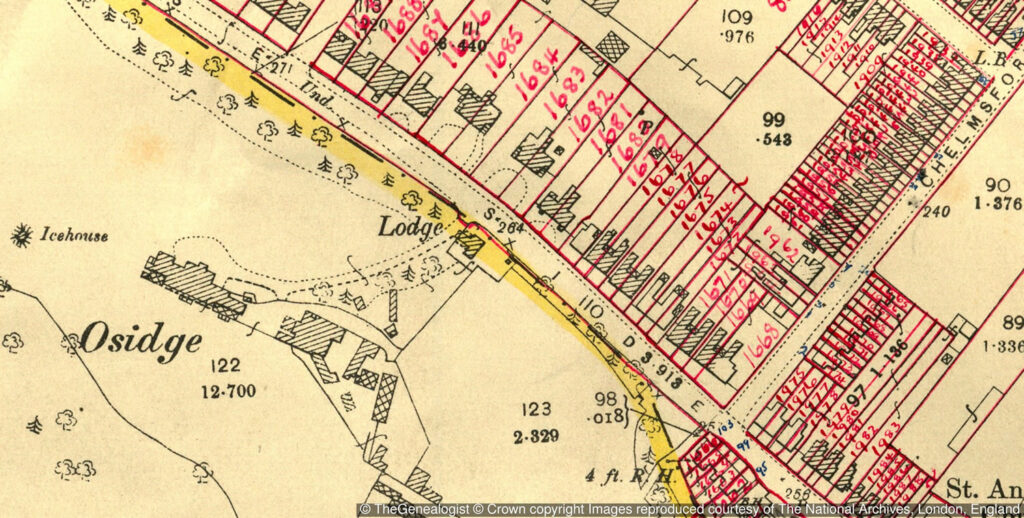
A valuable side effect of the introduction of the survey was the creation of the 1910-15 Valuation Office maps and field books. Known to many researchers as the Lloyd George Domesday Survey (because of the echoes of the original 11th century Domesday survey by William I), the Valuation Office Survey was a nationwide survey of all houses, workshops, farms and other buildings and which recorded details such as the owner, occupier, value and the number of rooms of each property.
The maps
The surveyors used large-scale Ordnance Survey maps to identify and allocate a plot number or an assessment number to each property and then enter the detailed information about it into ‘field books’ which recorded a description of each plot and what stood upon it. These records are very useful for researchers who are exploring land values, land ownership and land occupancy as well as for house, social or family historians wanting to gain an understanding of the areas in which their ancestors may have lived at a time just before the First World War broke out.
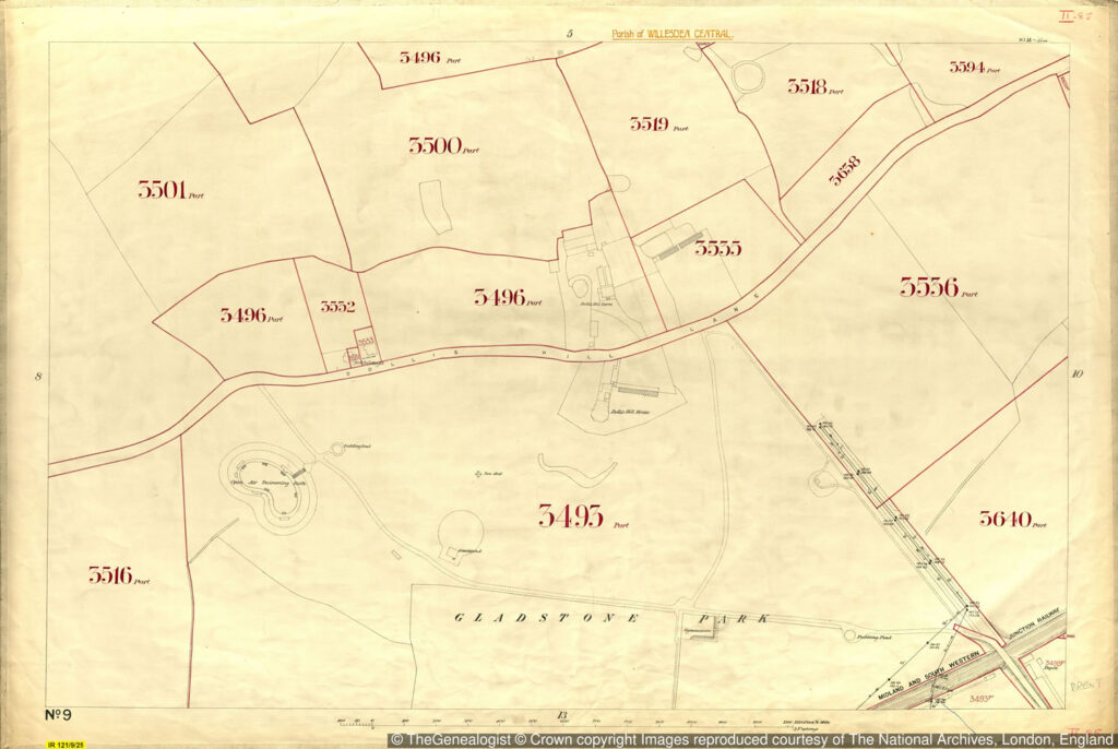
The maps in series IR121/1 to IR121/22 and IR124/1 to IR135/9 are now in the safekeeping of The National Archives in Kew and there is an ongoing project to make these excellent maps and their accompanying book records (IR58) available online at the commercial website TheGenealogist. All of the London boroughs and North Buckinghamshire are currently fully searchable on this platform with new areas promised to be released in the near future.
To search the Lloyd George Domesday Survey:
https://www.thegenealogist.co.uk/search/advanced/landowner/1910-survey/