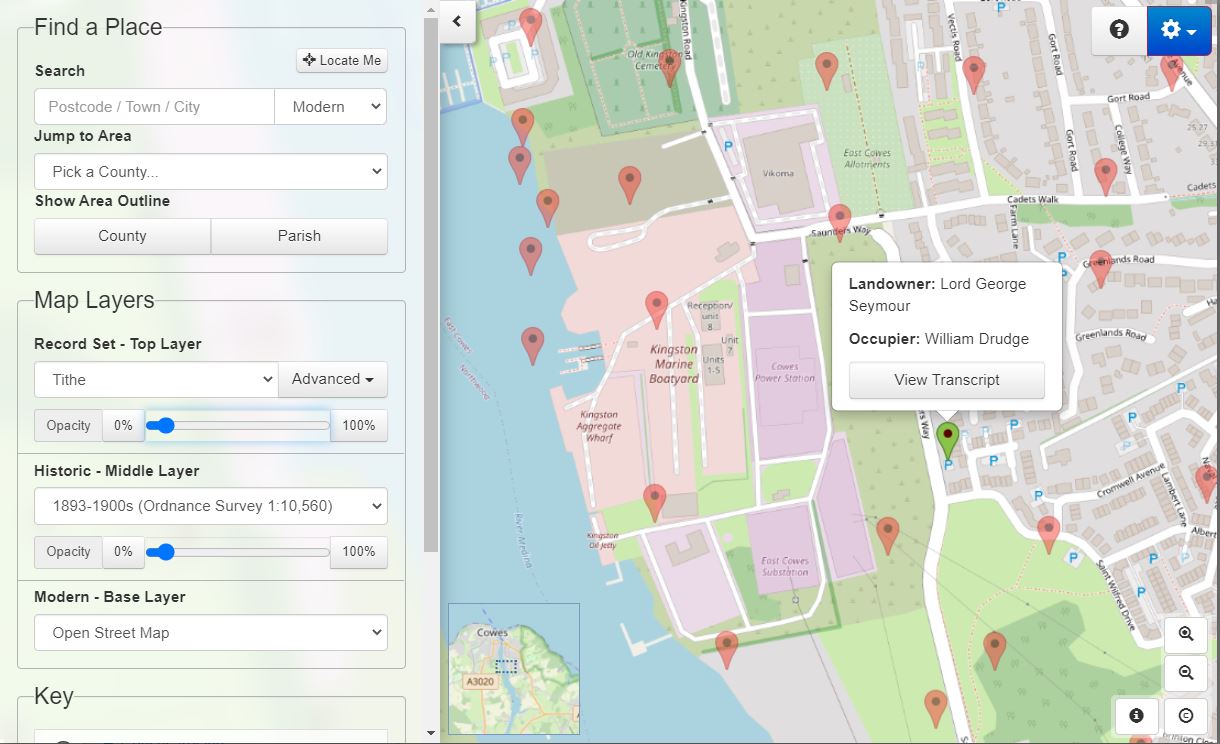
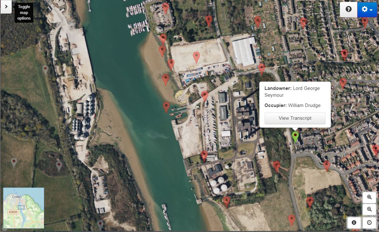
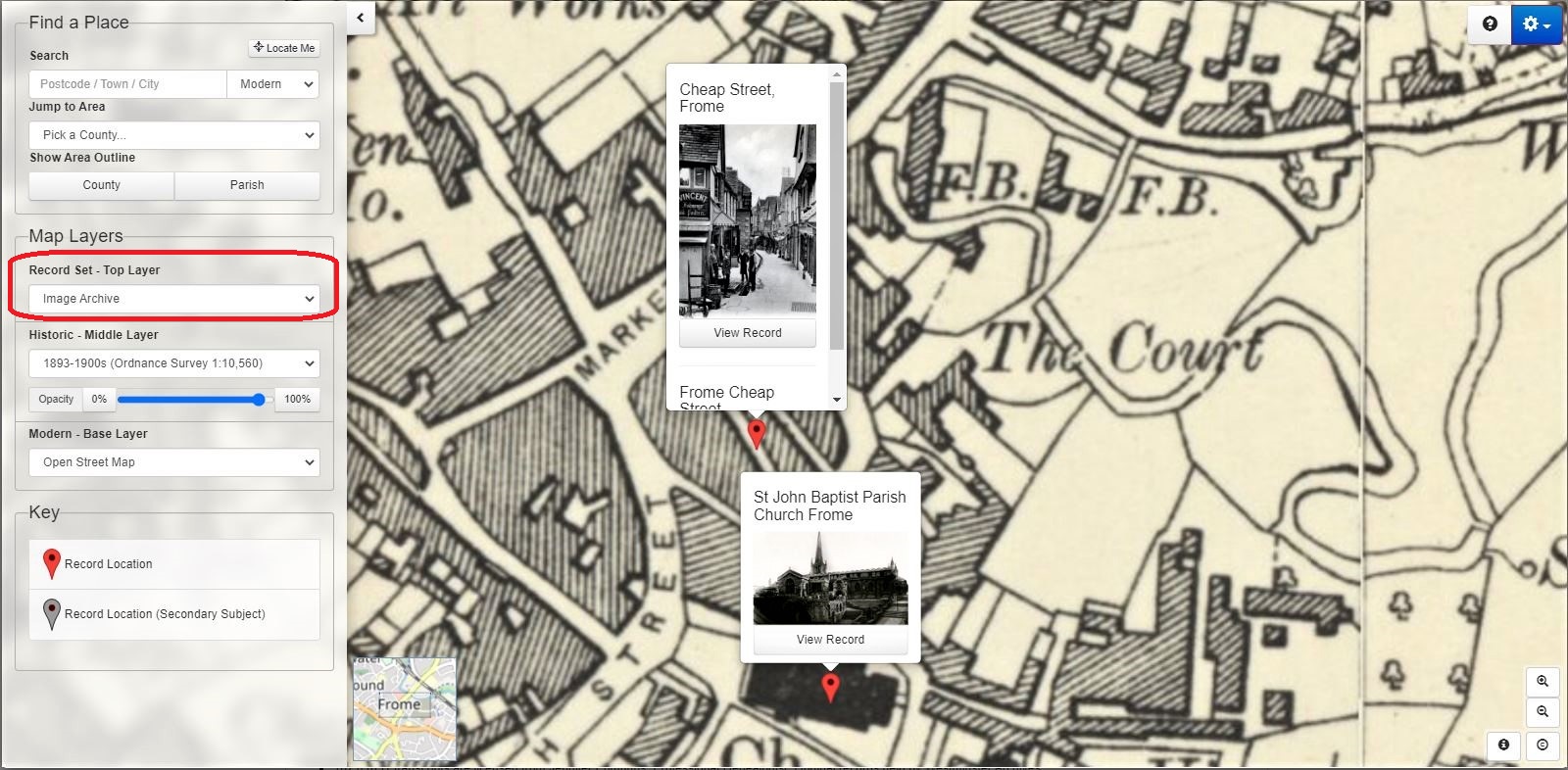
Family history research website TheGenealogist has added to its site an innovative map interface for its subscribers to investigate the places where our ancestors had lived, worked and played. Given the name Map Explorer, this interface adds rich functionality to the websites growing collection of map-based records. This powerful tool has been developed with georeferenced historic maps overlaid over several modern background maps including Ordnance Survey, OpenStreetMap and Bing satellite and hybrid road/satellite view.
The tool boasts a dashboard on the left of the Map Explorer’s display that puts various different tools, such as a Modern and Historic Place Search, County and Parish Boundary Indicators, and the ability to manipulate the map layers in the hands of the user.
Map layers
Map Explorer’s maps are divided into three types of layers that can be viewed on top of each other like sheets of paper. The interface boasts the ability to change the transparency of a layer which enables you to view the layers beneath. The benefit of this is that it allows you to see how the area may have changed over the years between the original publication of each map.
The base layer
Map Explorer’s base layer is the modern layer. Here there is a choice and you can select between a modern OS map, OpenStreetMap or a Bing Satellite Image.
The historic layer
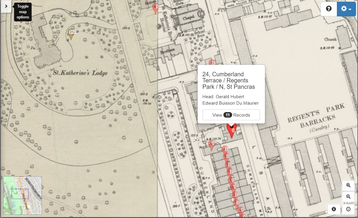
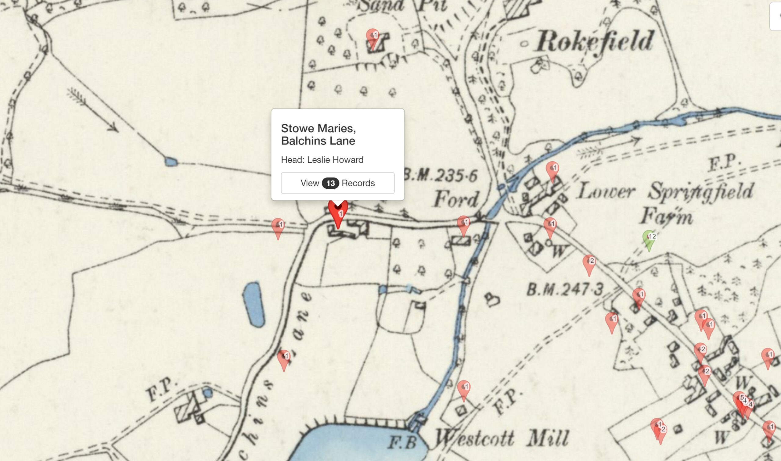
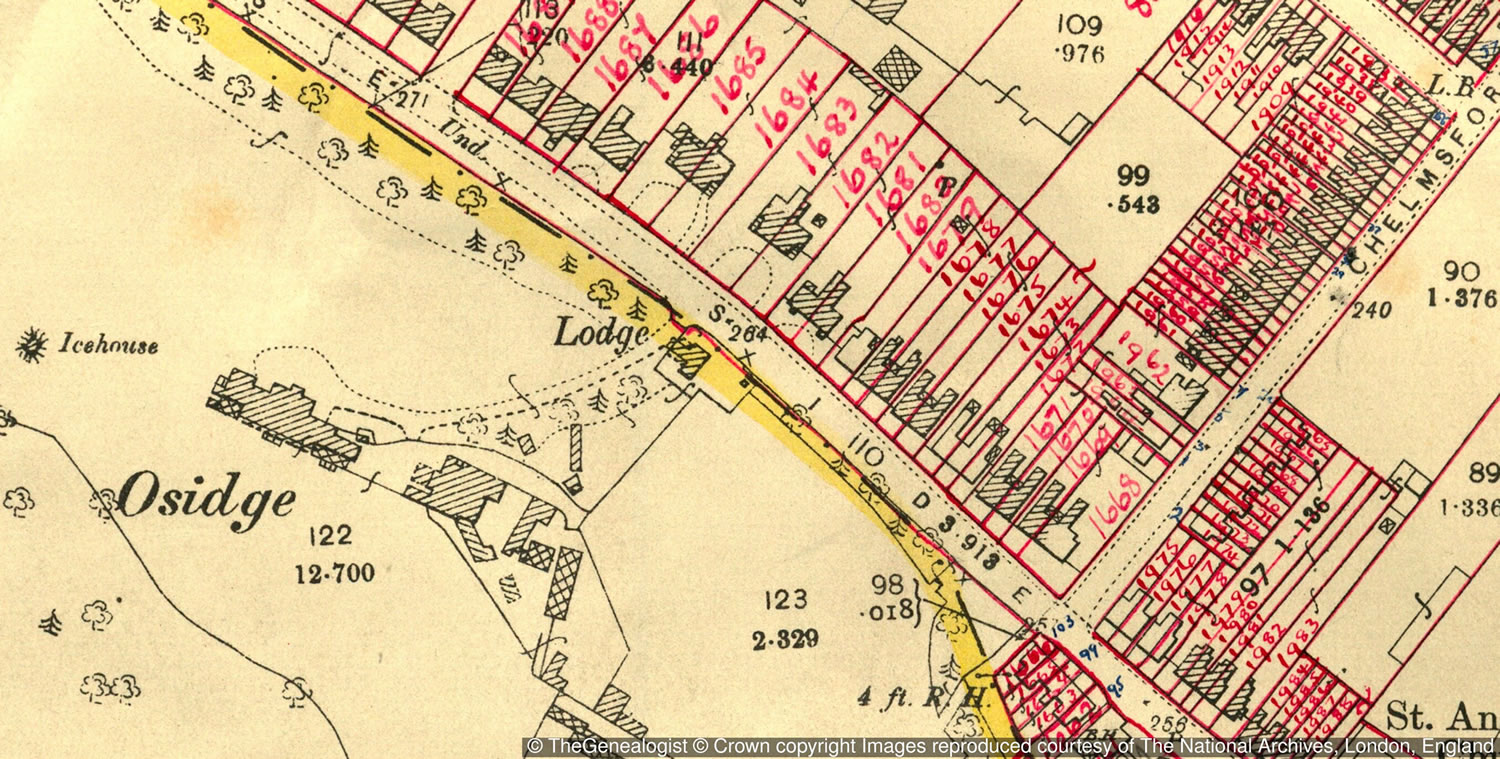
The historic layer on Map Explorer can be used to select from a range of period OS maps dated from the 1890s to the 1960s.

Record set layer
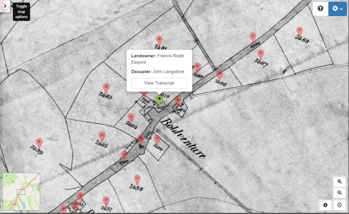
This layer provides access to map record sets available from TheGenealogist such as the census records, Lloyd George Domesday Survey, or georeferenced tithe maps. Further record sets are being added to this layer all the time. This layer also has the ability to show ‘pins’: these are map markers that link directly to the records so you can see who was living in a particular property at the time the record was created.
Putting your ancestors on the map
The Map Explorer doesn’t just display maps – you’ll see georeferenced ‘pins’ on the map where you have found records for the properties beneath. This is currently available for the Lloyd George Survey records, but the site plans to add more record sets over the coming months.
This genealogical research tool, combining maps and residential data, gives those family historians who want to investigate where their ancestors lived some powerful features to use.
The Map Explorer is available to all of TheGenealogist’s Diamond Subscribers, from the Search tab. See a video and read more at: https://www.thegenealogist.co.uk/maps/