Ordnance Survey (OS) is the national mapping agency for Great Britain that since 1 April 2015 has operated as Ordnance Survey Ltd, a government-owned company. It received its name from its original military purpose (ordnance – military supplies including weapons, ammunition etc, and surveying – examining and recording the area and features of an area of land in order to construct a map) when the British Government needed to map Scotland in the wake of the Jacobite rising of 1745.
The task of surveying Scotland fell to a young engineer called William Roy who began the initial small-scale military survey of that country aged just 21. Starting in 1747 and over the next eight years Roy and his surveyors completed what was known as the Great Map at a scale of 1:36 000 (1.75 inches to a mile). Described by Roy as rather a ‘magnificent military sketch than a very accurate map of the country’, it plotted roads, hills, rivers, types of land cover and settlements.
William Roy thought it was very important to create a superior map of the whole of the British Isles to those available at the time. Roy was by this time building his reputation and had been commissioned in 1784 by the Royal Society to settle a question as to the relative positions of the Greenwich and Paris Observatories. To do this he required a more sophisticated theodolite (a precision instrument that measures angles horizontally and vertically) than had previously existed. His theodolite was created for him by Jesse Ramsden, the leading instrument maker at that time, taking three years to produce and measuring three feet across. With the theodolite Roy began to triangulate a series of accurate measurements to France and back.
Some years later, on 21 June 1791, the Board of Ordnance (equivalent to the defence ministry in modern times) purchased a second improved version of Ramsden’s theodolite and this date is officially recognised now as the date of the birth of Ordnance Survey.
As the French Revolution (1789–1799) played out across the Channel the government ordered its Board of Ordnance to begin a survey of England’s vulnerable southern coasts. Up to then maps had lacked the detail the military needed for moving troops and planning their campaigns and with the threat of invasion during the Napoleonic Wars it saw the need for a more general and nationwide set of maps.
The first Ordnance Survey map was published in 1801 and was of England’s most south-easterly county, Kent – one area thought most vulnerable to French invasion.
From the 1840s, Ordnance Survey developed the ‘County Series’. Ordnance Survey maps of England, Scotland and Wales that we can use today include:
- One inch to the mile – useful for an overview of wide areas. The first edition ran from 1856–1891, with later editions continuing through the 20th century until the early 1970s.
- Six inches to the mile – useful for rural detail, showing heights and contour lines. The earliest examples date from the 1850s for England and the 1840s for Scotland, and continued until the 1880s. Later editions were produced until the 1950s.
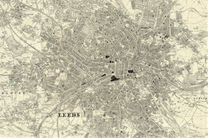
- 25 inches to the mile – the most detailed maps for all inhabited urban and rural regions. The first series ran from 1855–1882, and later editions from 1892 to 1949.
Ordnance Survey mapping is usually classified as either ‘large-scale’ (in other words, more detailed) or ‘small-scale’. The Survey’s large-scale mapping comprises 1:2,500 maps for urban areas and 1:10,000 more generally. (The latter superseded the 1:10,560 ‘six inches to the mile’ scale in the 1950s.) These large-scale maps are typically used in professional land-use contexts and were available as sheets until the 1980s, when they were digitised. Small-scale mapping for leisure use includes the 1:25,000 ‘Explorer’ series (successor to the ‘Pathfinder’ range), the 1:50,000 ‘Landranger’ series and the 1:250,000 road maps. These are still available in traditional sheet form.
Ordnance Survey mapping published in the last 50 years is in copyright and and so it is not freely made available online for reuse. Some online map websites do have a licence so that these maps can be viewed – such as Streetmap.co.uk.
Older maps that can be used for family, house or social history can be found on websites such as TheGenealogist, which has a powerful interface that allows a researcher to see georeferenced historical OS and other maps overlaid over modern street maps, and the National Library of Scotland online maps site.