Parish records are a very important resource for researching our ancestors, especially before the introduction in 1837 of civil registration records in England and Wales. Researchers, having found the name of a parish, will then want to find a map that will show them the extent of the parish both geographically and perhaps ecclesiastically so that they are able to identify where church-related vital events such as baptisms, marriages and burials may have been recorded.
One of the most useful resources for this is the book The Phillimore Atlas and Index of Parish Registers. Famed among researchers for being useful for finding the location and extent of parishes, it was first published in 1984 and has been revised several times. Edited by Cecil R. Humphery-Smith, it includes parish boundary maps, with a summary of locations and indexes for England, Scotland and Wales.

The publication includes within its 320 pages many county parish maps which show the pre-1882 parochial boundaries, colour-coded probate jurisdictions, starting dates of surviving parish registers, as well as the churches and chapels.
Topographical maps face each of the ‘parish’ maps, and they show the contemporary road system and other local features, to help deduce the likely movement of people beyond the searcher’s starting point.
The index lists the parishes, with grid references to the county maps. It indicates the present whereabouts of original registers and copies, and whether a parish is included in other indexes. It also gives registration districts and census information.
This invaluable guide will allow the user to quickly find answers to such questions as: Have the registers been deposited? Where may they be found? What outside dates do they cover? Have they been copied or indexed and by whom?
Available from book and genealogical suppliers, this is the top resource for many family historians researching their forebears and wanting to see the boundaries of a parish as well as the contiguous parishes to where their ancestors had lived when no sign of the person appears in the expected parish.
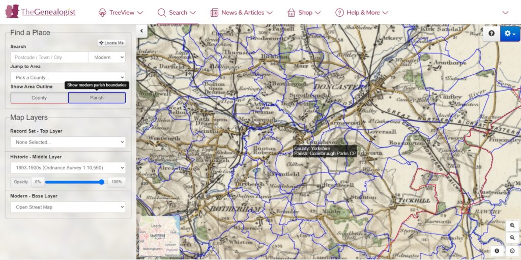
Online, commercial website TheGenealogist’s Map Explorer tool allows its subscribers to select a modern parish outline when using its record sets. This can point a researcher towards where to look for other records, visualise how large the parish is and see the surrounding parishes that ancestors may have moved to or from. https://www.thegenealogist.co.uk/maps